Yazman Mandi
Yazman Mandi is a Tehsil of District Bahawalpur. It is located at the edge of the Cholistan Desert. It is also known as “Bab-e-Roohi,” which means “start of the desert.” Sir Muhammad Sadiq Khan Abbasi, the Nawab of Bahawalpur, advocated renaming the town “Yazman” and opening it up for settlement after visiting Iran and Iraq. As a result, several families from Sheikhupura and Faisalabad immigrated to help develop the area.
Each family was granted 23 acres. The Desert Bahawal Canal, built between 1926 and 1928, played a key contribution in making the area fruitful. Yazman Mandi became a notified area in 1957 and was granted Union Council status in 1960. After 1955, the next years ushered a new age of prosperity and progress, with the infrastructure being fully upgraded.
This city attained the title of Tahsil on July 1, 1984, and has made significant socioeconomic and agricultural improvement. It provides a variety of attractions for travelers. There are several historic and cultural sites in and around the city, including Cholistan Desert, the Shrine of Channan Pir, and Derawar Fort.
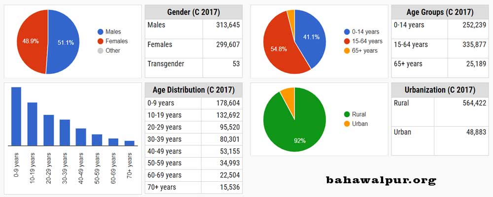
Yazman Mandi total population, according to the 2017 census, is 638,494. A total of 299,607 people are female, 313,645 people are male, and 53 people are transgender. The demographic distribution also shows that there are 252,239 children in the population between the ages of 0 and 14, and 335,877 people between the ages of 15 and 64. Furthermore, the demographic study indicates that there are 25,189 people in this tehsil who are 65 years of age or older. These figures give a thorough picture of the community’s age and gender distribution and are helpful in understanding a range of social, economic, and developmental factors.
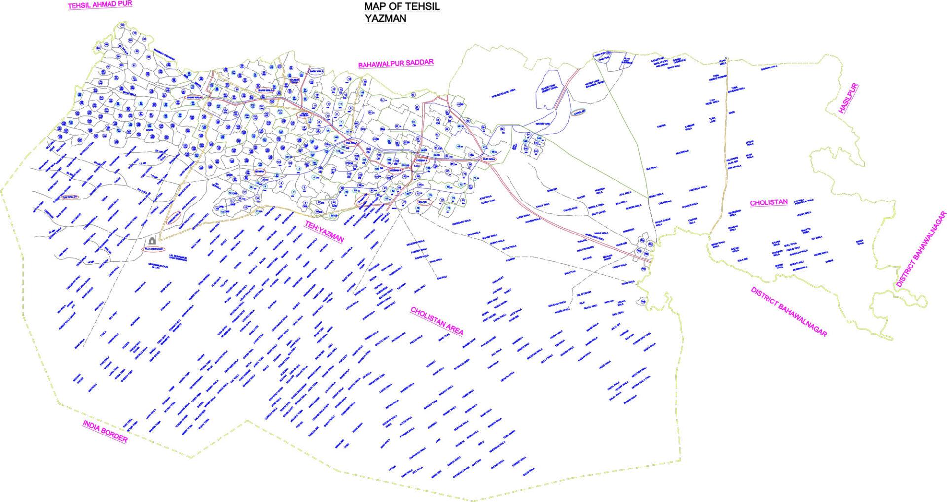
Tehsil Yazman Map

